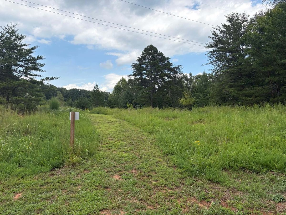
From the back, right corner of Lilly’s Leisures on Diamond Ave., Sycamore Street doesn’t look particularly close.
But residents in the community talk of riding their bicycles from Diamond over to Sycamore, some as long ago as the 1950s.
It doesn’t look accessible at all.
At first glance, all that can be seen is a narrow opening between two buildings. It leads away from the senior-housing complex, across a pasture, and into the woods. The overgrowth and trees make it difficult to see what lies beyond the tree line.
The walk begins.
Out into the pasture with waist and chest-high grass and weeds.
In the distance, the faint hum of a motor leads the way like a beacon.
Across the pasture and through the tree line, a small path appears and continues along the edge of the creek and pasture.
The sound grows louder.
The walk continues.
There is no pavement.
In places, the ground near the creek is boggy, almost marsh-like—even with the lack of rain. Boots imprint slightly into the soft earth.
The conditions make it difficult to imagine simply laying pavement across it. Any actual road would require engineers to determine what drainage, stabilization, permitting, or foundation work would be necessary.
But the direction is unmistakable—a small, dirt path winds its way through the woods alongside the creek, and it leads increasingly toward the ever-loudening sound of a motor.
Six minutes and 18 seconds later, the path exits at a paved road.
The noise turns out to be a man mowing his yard nearby.
There is no street sign, but he confirms it.
Sycamore.
After decades of discussions about giving Diamond Avenue residents another way out, the distance—or lack thereof—is almost jarring.
Getting there on foot is easy.
Building a road has proved anything but.
Routes before roads
The history of a second entrance to Diamond Avenue stretches back years—through different Town Councils, different Boards of Supervisors, different administrators, and different proposed routes.
For Phyllis Dunnings, 74, the problem is older than most of the plans now sitting in government files. Dunnings has lived in the neighborhood essentially all her life.
“It’s always been one way in, one way out.”Phyllis Dunnings, 74, who has lived in the neighborhood nearly all her life
Sycamore Street is not a new idea to her, either. It is one of the places residents have heard discussed again and again as a possible answer.
Keith Holland, who served as Rocky Mount town manager from 1998-2007, remembers former town official Arnold Dillon discussing a Diamond-to-Sycamore connection.
Holland also remembers considering an extension of Compton Street near North Main Street that could have opened additional land behind Technology Drive.
“I was told that the major landowner was not amenable to selling land or right of way for the road extension, but I never spoke directly with him to confirm,” he says.
Other demands were competing for the town’s attention.
“The town had annexed the Rt. 40 East corridor, Franklin Heights, and Muse Field Rd in 2001, and extending utilities to serve those new areas took up most of our capital improvement focus for a few years,” Holland says.
The Diamond idea remained just that—an idea.
Then came the bridge.
Former Town Manager James Ervin remembers the bridge problem arriving early in his tenure.
“Early in my employment the bridge was deemed unsafe and was to be ‘weighted’ in VDOT parlance,” Ervin says. “This meant no fire trucks could cross.”
The town and VDOT responded on Aug. 21, 2008.
“We worked with VDOT to replace it,” Ervin says. “VDOT sourced some steel that we cut to fit, we sourced new decking and decking bolts. Our crews worked together.”
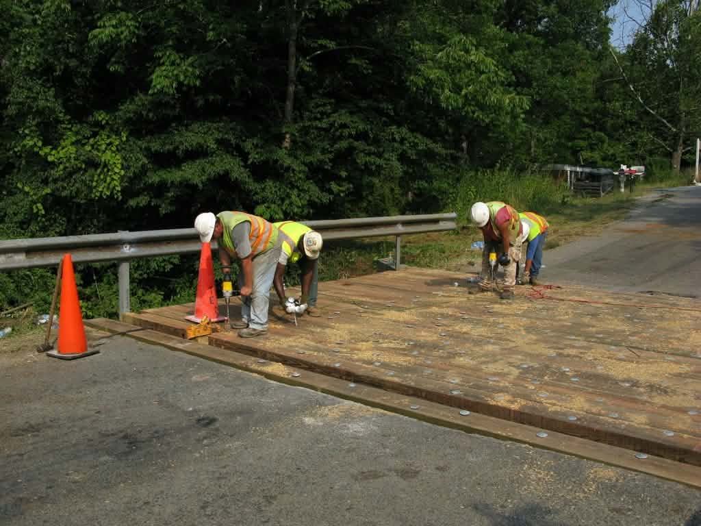
At roughly the same time, Ervin says, officials were looking for something bigger than a bridge repair.
Another way out.
“We drafted a route for a new road without complex engineering,” Ervin says.
Actually, several routes were considered.
“One did exit on Sycamore,” he says.
Ervin says some routes would have required acquiring or condemning private property, something Franklin county officials at the time did not consider viable.
That account establishes that a Diamond-to-Sycamore connection was more than neighborhood speculation by 2008.
Officials had begun putting routes on paper.
The land in between
One proposed route crossed a large cattle farm—what many refer to as the Old Smithers Farm—between Diamond Avenue and Sycamore Street.
Over the years, a simplified version of what happened next has circulated: The property owner declined to sell—but that synopsis is not accurate and demands explanation.
Interviews with members of the family that lived there tell a more complicated story.
Ginger Smithers says her father, Kelly Smithers, was not opposed to helping create another way out for the neighborhood. What he objected to was the alignment officials brought to the family.
She remembers VDOT laying out the proposed alignment.
“They were going to cut the road right down through the middle of the farm and go by the front porch of the house,” she says.
There was another problem.
The low bridge area on Diamond Avenue was subject to major flooding, she says.
While improvements and upgrades have since been made to curb flooding in both the Diamond and Sycamore areas, during the time the Smithers owned the land, both areas were subject to flooding. And that also played a part in her father’s decision.
Ginger Smithers says it was assumed that if access to Sycamore could be gained, residents would be able to use Sycamore to avoid flooding. However, Sycamore also had a low area with only a pipe under the road that also flooded.
The creek that still travels under Sycamore continues to Diamond, which at the time made Sycamore equally problematic, not a solution. Basically, if it was flooding on Diamond, it was already flooding on Sycamore.
Hence, the family felt any new proposed route should have been moved farther up the road to avoid the low-lying areas.
Kelly Smithers knew Sycamore Street. His daughter says he helped dynamite and install the road as a young man.
“If you’re going to put a road in, you need to solve it,” Ginger Smithers says of her father’s position.
She says her father wanted officials to look farther uphill away from the creek area.
“He told them that they needed to come up with a plan where they would have a road, a decent road, and a decent bridge,” she says, preferably along the preserve and closer to the area that later became the YMCA/Technology Center on Technology Drive.
At some point, discussions turned to buying property. Ginger Smithers says officials made an offer. Her father countered. No agreement was reached.
But, she says, that was not the end of his thinking about another route. He wanted officials to develop a better plan.
According to the family, however, officials stopped coming back after that.
“It was a bad plan,” Ginger Smithers says of the alignment her father rejected. “A plan should have been looked at and figured out, and they should have done something about it a different way. He wanted to help the community.”
Gail Smithers remembers the discussions similarly.
The family had cattle on the land, and cutting a road through the working pasture presented practical problems.
“We couldn’t see the point of coming through that farm for us to have the fence on each side and continue with the road going through the middle of it,” Gail Smithers says.
She also questions whether the proposed outlet would have solved the larger access problem.
“Sycamore Street is no better road than Diamond Avenue Extension,” she says.
The county made an offer, Kelly Smithers countered, and all negotiations suddenly stopped.
“We didn’t hear anymore out of them,” Gail Smithers says.
The distinction matters.
The failure of that route cannot accurately be reduced to one landowner simply refusing to let a road cross his property.
There was a proposed alignment. There were objections. There were discussions. There were alternatives. There were negotiations.
Then all discussion stopped.
The family makes one thing clear:
It wasn’t Kelly Smithers who stopped talking—it was the county.
A road on a planning map
By 2011, Diamond Avenue had made its way into regional transportation planning.
Joe Bonanno, senior planner with the West Piedmont Planning District Commission, says Diamond Avenue appears in the Rural Long-Range Transportation Plan adopted in 2011. The plan itself calls for a “long-term upgrade to current standards” from Franklin Street to the proposed Virginia 40 bypass.
That bypass matters.
Maps from the period show Diamond Avenue in relationship to a proposed Route 40 bypass west of Rocky Mount. The concept could have created something far more significant than a short neighborhood connector: another route into the larger road network.
The idea also appears in local planning documents as an extension of Diamond Avenue to a future Route 40 bypass.
Bonanno says the bypass does not appear in the later updated rural transportation plan.
Why it disappeared is less clear.
Bonanno points to SMART SCALE, Virginia’s system for ranking major transportation projects, as one possible factor because entirely new roadways can be difficult to advance through competitive programs.
Whatever the reason, another potential solution disappeared from the active planning landscape.
By 2015, however, Diamond Avenue remained a recognized problem. Rocky Mount’s comprehensive planning called for working with the county on alternative access.
Still, no road appeared.
Three more possibilities
Billy Ferguson became Franklin County’s director of public safety in 2017. By then, the Diamond Avenue problem was familiar.
Residents had approached the Board of Supervisors more than once looking for answers, Ferguson says. He and county officials went looking for them.
Ferguson says he and former Director of Planning and Development Steve Sandy examined three potential routes.
One possibility ran toward Peter and Edgemont streets. Ferguson remembers the terrain as difficult and believed construction there would be expensive.
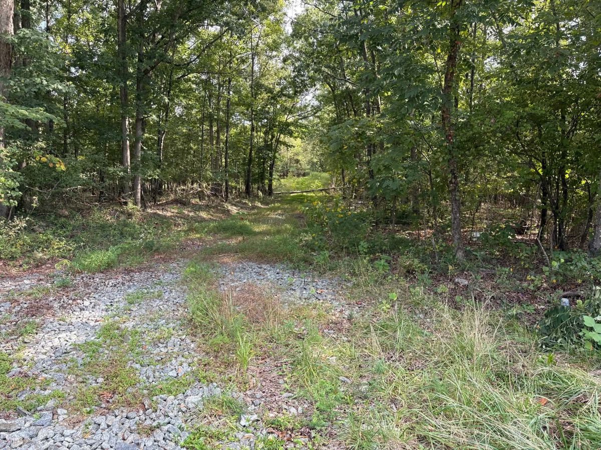
Another ran behind Lilly’s Leisures toward Sycamore—essentially the area that can still be walked today.
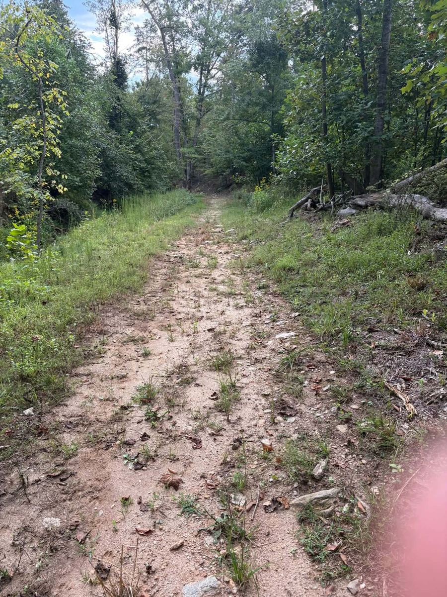
Around 2019 or 2020, that possibility got unusually close to becoming something tangible.
AEP was replacing utility poles in the area and needed temporary access for heavy equipment. Ferguson says the utility constructed a rough road using large stone.
County officials saw an opportunity.
“Well, we had met with AEP and talked to them and kind of worked out a gentleman’s agreement,” Ferguson says. “There was never nothing on paper, nothing. It was kind of just like, ‘Hey, can y’all do this for us?’ And it’s like, ‘Yeah, yep,’ and so they agreed to leave that temporary, what I call a road, in there.”
For a moment, a route that had existed largely on maps and in conversations had something resembling a roadbed on the ground.
The problem came near Sycamore Street.
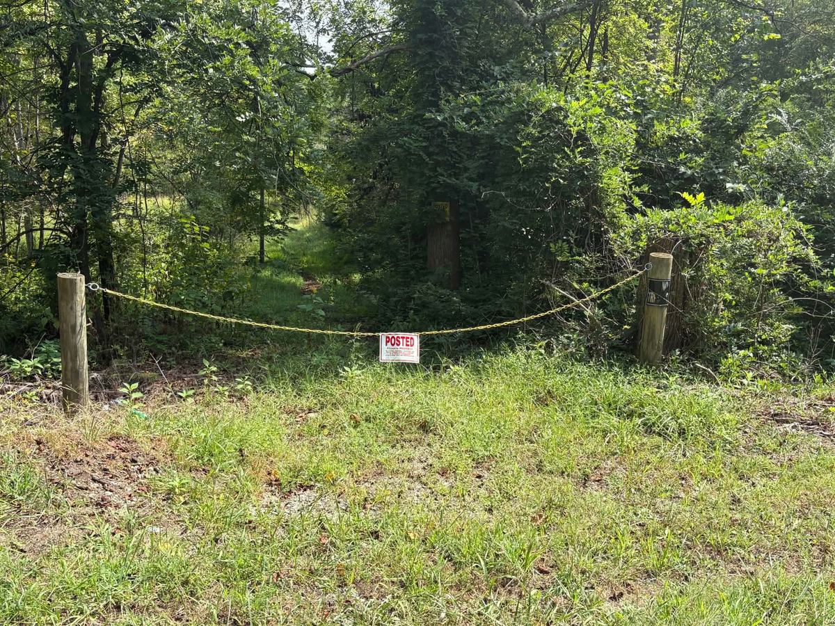
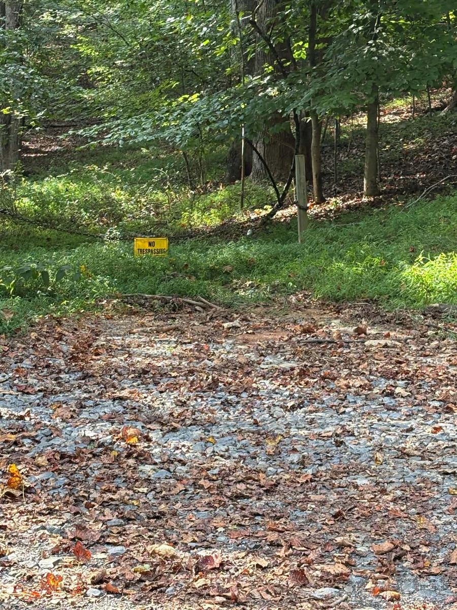
Completing the connection required crossing a small piece of privately owned property. Ferguson says a community resident who controlled the needed property understood the need for emergency access but worried that even a gated route could eventually become a gathering place where people drank and left trash.
County officials discussed making it a gated, emergency-only entrance—something residents did not want, as they still push for a real, hard-top road—not an emergency road with a gate. A real road.
An engineer also walked the area with county officials, Ferguson says. Wetlands presented another consideration, along with cost.
In the end, no agreement was reached.
Another route disappeared.
Still, Ferguson’s conclusion was not that a connection was impossible.
“It’s something that could be done,” he says.
It would simply cost money.
The road that keeps coming back
The third general area Ferguson remembers studying involved the former Smithers Farm between the two streets.
Ferguson knew the former owners and says that at one point, he acted as a liaison between the family and county officials. His recollection differs in some details from the family’s account of earlier discussions, but on the larger point the accounts converge.
Officials considered the property.
Property acquisition became an obstacle.
Nothing was built.
Part I of this series detailed Ferguson’s broader frustration with the county’s repeated cycle of attention to Diamond Avenue—periods when the issue would rise, officials would look for solutions, and momentum would fade again.
That history matters here because the routes did not vanish for one single reason.
One ran into terrain. One ran into private property. One reached the point of a rough emergency roadbed but stopped short of a completed connection. Another depended on a bypass that never materialized.
The common result was the same.
No second road.
What about Mike Carter?
That history has become more contentious recently.
Mike Carter, who represents the Rocky Mount District on the Franklin County Board of Supervisors, makes a stronger claim about his own role. An exchange occurred after a recent BOS meeting. Carter approached NAACP President Eric Anspaugh about the issue.
“I worked for 10 years to get something done, but the town wouldn’t have anything to do with it,” Carter told Anspaugh. “Now the mayor is trying to push it all back on me.”
Mayor Holland Perdue disputes the suggestion that he has tried to place responsibility on Carter.
“I haven’t said anything about Mike Carter,” Perdue says. “I’m just not familiar with what Mike has done for Diamond Avenue.”
Perdue says the town has asked county staff to provide information about Carter’s efforts and says he is not the person to answer what the town and county may have discussed a decade ago.
Carter also mentioned during the meeting and to Anspaugh afterward that he had many files on Diamond Ave., and that he would like to turn them over to the town.
Town Manager Robert Wood confirms the files were delivered Wednesday.
Moreover, Carter has not responded to requests for an on-the-record interview for this story.
Ferguson does remember Carter advocating for the neighborhood. But he draws an important distinction between acknowledging the problem and aggressively pushing a project.
“I’m not saying it was forceful speaking and how much he pushed it, but he would speak,” Ferguson says. “It would usually be along the lines of ‘We need to see about getting something done over there. We need to take a look at that.’”
Ferguson describes those comments as broad rather than project-specific.
“There was never any, ‘Well, we need to look at some funding sources,’ or, ‘Can we get grants for this?’” Ferguson says. “It was kind of just broad-stroke comments.”
Ferguson makes the distinction again.
“I’m pretty sure that Mike Carter did advocate for it, but I would just say it wasn’t a powerful advocation.”Billy Ferguson, former Franklin County director of public safety
Ferguson remembers former Rocky Mount District Supervisor Charles Wagner advocating for the issue as well.
The problem, Ferguson says, was gaining enough support from the rest of the Board.
Route B
By April 2023, Franklin County was again considering another entrance.
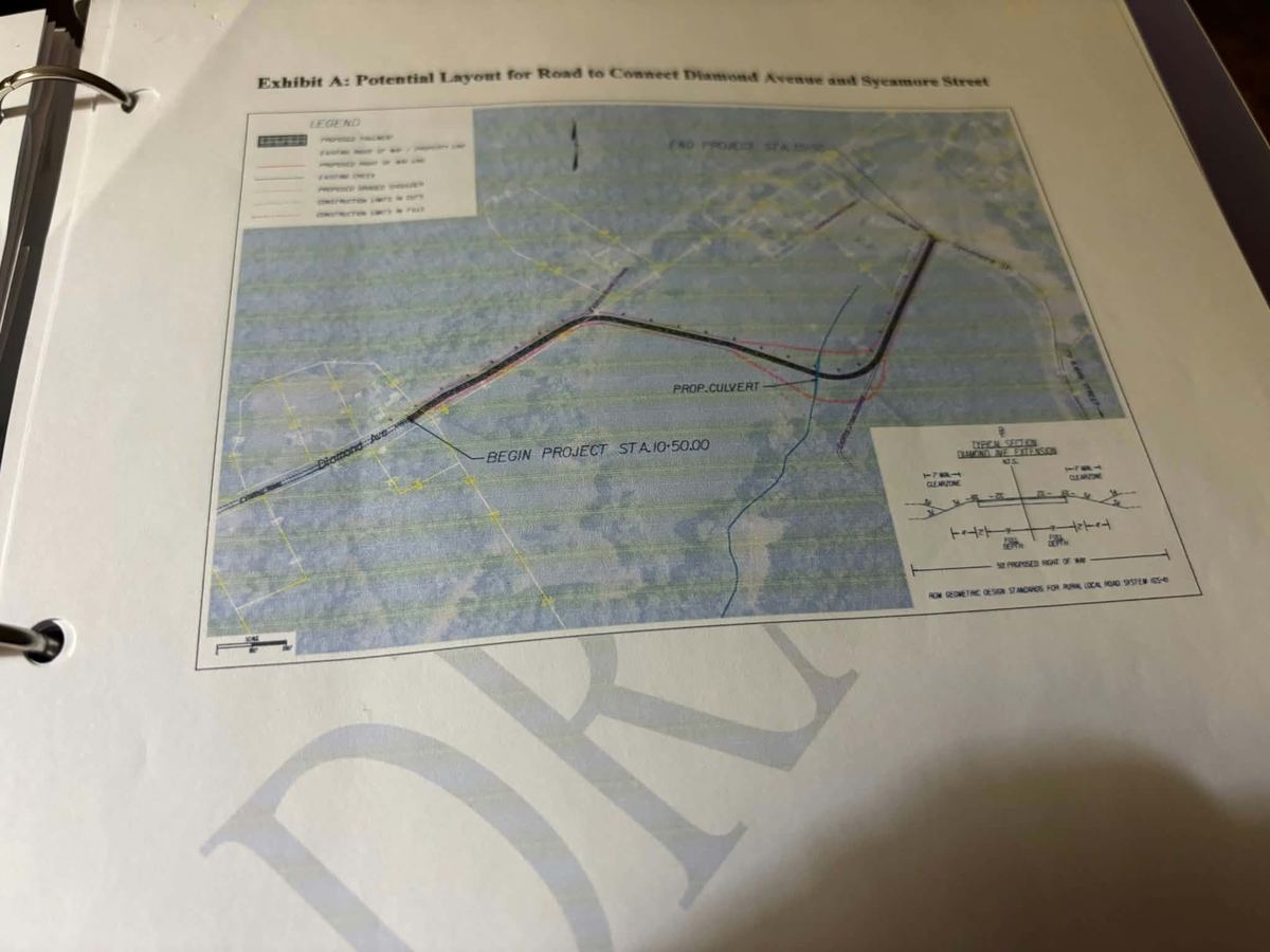
This time, officials went far enough to direct that a cost estimate be prepared for what became known as Route B.
The proposed alignment ran from the Diamond Avenue side toward Sycamore across the broad tract that had long sat between the two roads.
GIS records help show how many pieces can be involved in what looks like a simple line on a map.
Along the general corridor are property owned by Monty Atkins at the end of Diamond Avenue, the large tract now owned by Foxfire Farms & Ready-Mix Service, several Sycamore Street properties, and the Grassy Hill Preserve along the north side.
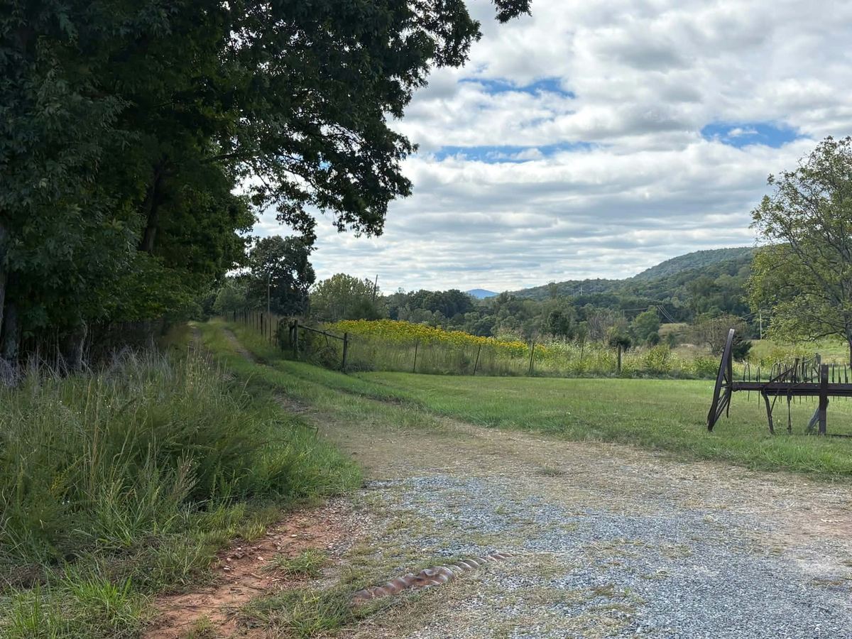
The large tract is the key piece. Foxfire Farms & Ready-Mix Service purchased an 80.8-acre parcel at 435 Sycamore St., a 2.2-acre parcel at 755 Sycamore St., and a nearby 5.76-acre vacant parcel from Gail Smithers in a single deed dated Nov. 9, 2023.
Seven months earlier, on April 18, the Board had directed that a Route B cost estimate be developed.
The relevant fact for Diamond Avenue is more basic: Ownership of much of the corridor changed.
Foxfire later added a one-acre Diamond Avenue parcel in August 2024.
The road still was not built.
And the records underscore why a proposed route is not the same thing as a road.
Property ownership, easements, right of way, grading, drainage, creek and wetland issues, engineering, and money all stand between a line on a map and pavement on the ground.
Another short way through
The Lilly’s-to-Sycamore path is not the only place where the physical distance between the two roads becomes striking.
Farther up Diamond Avenue, property owned by Atkins sits, by his estimate, roughly 100 yards from Sycamore Street.
The existing driveway is about one-tenth of a mile long, but it is an easement that passes through the Grassy Hill Preserve. That distinction matters: The driveway itself should not be confused with a simple strip of Atkins property available for a public road.
Moreover, the precise relationship between the easement, the Atkins parcel, and any proposed alignment would require engineering and property work.
But standing in the area makes the geography difficult to ignore.
Sycamore is close.
Again.
Atkins has lived on the property since roughly the early 1990s, but his family’s connection to the land reaches much farther back. He says his grandparents’ place dates to 1926.
The two-acre tract is surrounded on multiple sides by the Grassy Hill Preserve. Atkins says his driveway itself crosses Preserve property by right of way.
He remembers older residents talking about traveling through the area decades ago and coming out toward Grassy Hill. He also remembers an old power-line route that could be used to get out toward Route 40.
Atkins supports creating another way in and out of Diamond Avenue. He sees a practical effect for his own property, but he also sees a potential downside.
“(It would) make my place worth more if they put a road right through here,” Atkins says. “And it might get town water and sewer since they put me in town limits here a couple of months ago.”
He points across his front yard to the vast area of land across the driveway.
“Look at that,” he says. “I don’t want to be looking at a subdivision.”
From the end of Atkins’ driveway, where it merges into his front yard, a power line leads through the weeds and away from the property.
“Sycamore is about 100 yards that way,” Atkins says, pointing to the power line area.
Another walk begins.
“Now watch out,” Atkins says. “There’s timber rattlers up in there.”
The thinning September foliage makes it slightly easier to see through the weeds to the ground—no rattlers so far.
The terrain is relatively flat, skirting along the bottom of Grassy Hill. In the short distance, what looks like an old tin shed pokes its roof above the towering weeds.
In no time, the area empties out into the back yard of a Sycamore Street resident.
The entire walk takes no more than a couple of minutes. Without the overgrowth—and with a clear direction—it would take even less. It takes far less time to get back to the Atkins land.
Atkins is correct about the distance between the two roads.
As many locals would say, the roads are within spitting distance of each other.
The shortest route isn’t necessarily the easiest
Wood says the current thinking is to look at an area that would begin just before the Atkins property where state maintenance ends, not pave the path behind Lilly’s Leisures.
Nor is the shortest visible connection necessarily the preferred one.
One reason is property ownership.
Wood says one possible route would require dealing with “a handful of four or five property owners,” making it more complicated.
The second reason, Wood says, is what else a road could make possible.
“By doing the road kind of the way that we’re envisioning it and having it go across that larger property, the hope would be that that would open up possibilities for housing,” Wood says, along with “some additional kind of secondary or indirect benefits from the project.”
That is the paradox surrounding Diamond Avenue.
A person can walk from one street to the other in minutes.
At another point, the gap is measured in roughly a hundred yards.
But the gap the residents measure is in years rather than distance.
Pressure from the room
The search for another road is no longer confined to old maps, government files, and abandoned alignments.
It’s Tuesday night, and about 30 people have gathered for a Franklin County NAACP meeting led by Penny Blue, chair of the organization’s Political Action Committee. Blue gives an update on Diamond Avenue, fields questions, and then begins helping residents organize to put pressure on state officials.
She invokes Frederick Douglass and Martin Luther King Jr. alongside Abraham Lincoln and Lyndon B. Johnson. Her point is that major political change did not come from government initiative alone; it also followed sustained pressure from Black Americans demanding action.
“We make it happen,” Blue tells the room.
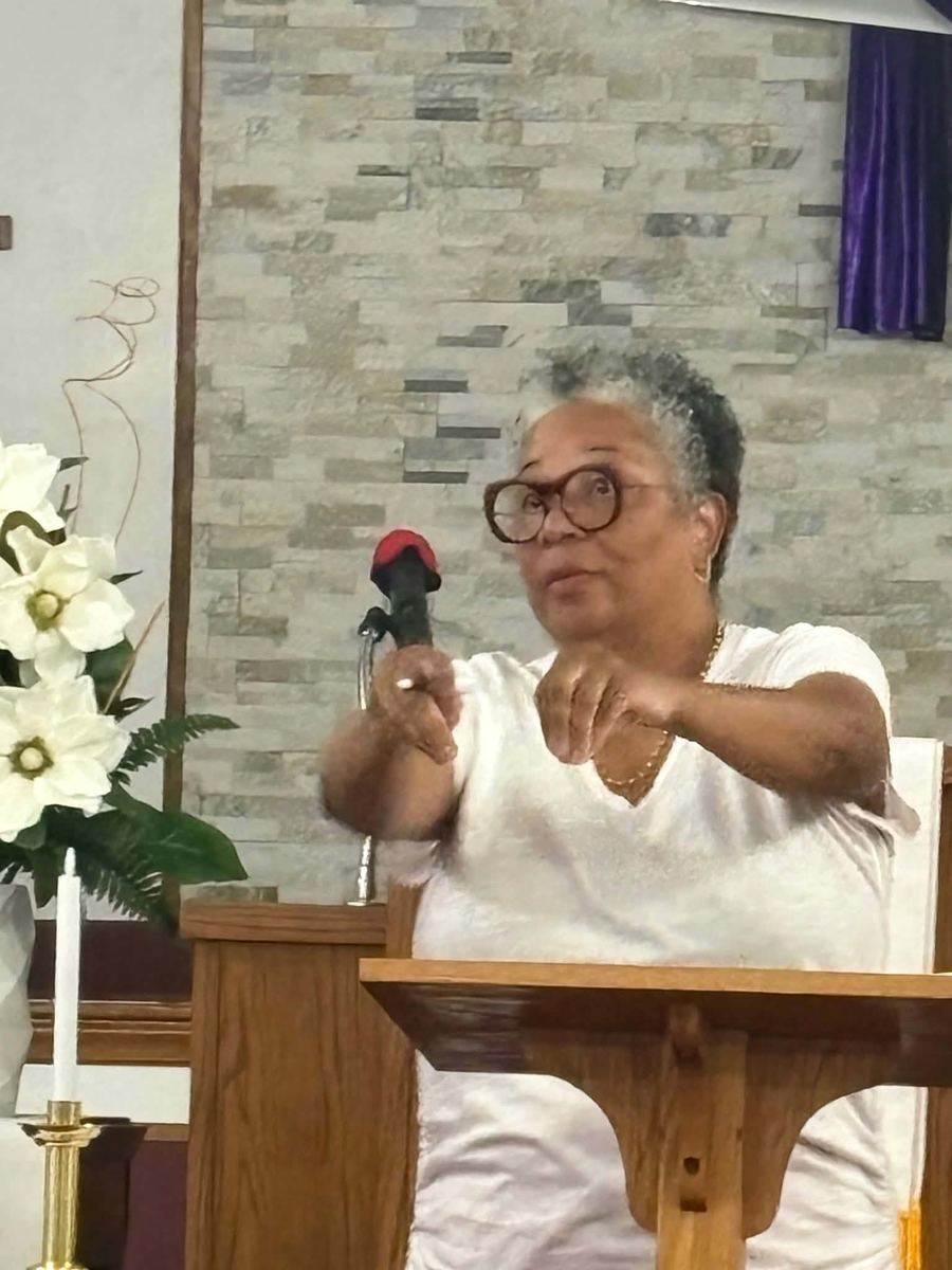
This time, she says, Rocky Mount’s mayor is asking residents to help create that pressure.
“Holland Perdue has asked for help, and we need to provide that help,” Blue says. “We have to put pressure on the people in Richmond.”
Blue asks for shows of hands: Who has called? Who has written letters? Who has attended Town Council meetings? Who has attended Board of Supervisors meetings? Then she hands out names and telephone numbers for residents to contact.
One resident echoes what most are saying.
“We’ve needed another way out for 50 years,” he says.
“And we been paying our taxes for 50 years,” adds another.
The Rev. Vandal Muse returns to the question of money.
“The reason they don’t have the money is because they spend it somewhere else,” Muse says.
Blue says the larger pools of transportation money are at the state level and tells the room that U.S. Rep. Morgan Griffith’s office contacted her after several people sent letters.
“The real money comes from the state,” Blue says.
She says Griffith’s office told her it would talk to state officials and members of the House of Delegates.
Blue also points to the mix of vulnerable residents and continued development in the neighborhood.
“How ridiculous does it sound that you have a neighborhood with day care and senior citizens,” she says. “And still building houses. How ridiculous is that?”
The Rev. Christopher Coates urges residents not to mistake silence for failure.
“There’s gonna be days when you feel like nobody is listening,” Coates says. “But you gotta keep talking.”
For Blue, the organizing effort returns to the same basic fact that has defined Diamond Avenue for decades.
“Our whole issue is one way in and one way out, and if there is an emergency and the train is coming by, we’re screwed.”Penny Blue, chair of the Franklin County NAACP Political Action Committee
Where it stands now
The problem now belongs largely to Rocky Mount following the boundary adjustment that brought Diamond Avenue Extension into the town in December 2025.
Perdue and Wood say the town intends to pursue it.
Rocky Mount has proposed replacing the bridge and creating another access point. It sought state funding for the work, and Perdue says officials will discuss setting aside town money during the budget cycle.
There are also potential state and federal funding mechanisms.
Bonanno identifies VDOT Revenue Sharing, which generally requires a local match, and federal transportation funding as possible avenues. He cautions that competitive programs weigh factors such as safety, congestion, accessibility, economic development, and other measurable benefits.
Whether Franklin County ever pursued similar grant funding for Diamond Avenue while the neighborhood remained under county jurisdiction is unclear.
“I’m not sure whether or not they had applied for any kind of grant like that in the past,” Bonanno says.
What is documented is a long succession of efforts: routes drawn on paper, land discussions, a bypass proposal, an AEP access road, engineering walks, emergency-access ideas, Route B, and repeated looks toward Sycamore Street.
And that may be the final irony of Diamond Avenue.
Its danger is defined partly by something that hasn’t happened.
The bridge hasn’t become unusable while an ambulance is trying to reach a patient. A disabled train hasn’t blocked firefighters from a burning home during a catastrophe.
The worst-case scenario residents fear has not occurred, but residents don’t want to wait for it to happen before another road finally does.
Back on Diamond Avenue, Sycamore Street remains on the other side of the woods.
It’s six minutes and 18 seconds away on foot from Lilly’s Leisures.
It’s roughly 100 yards away from the Atkins property.
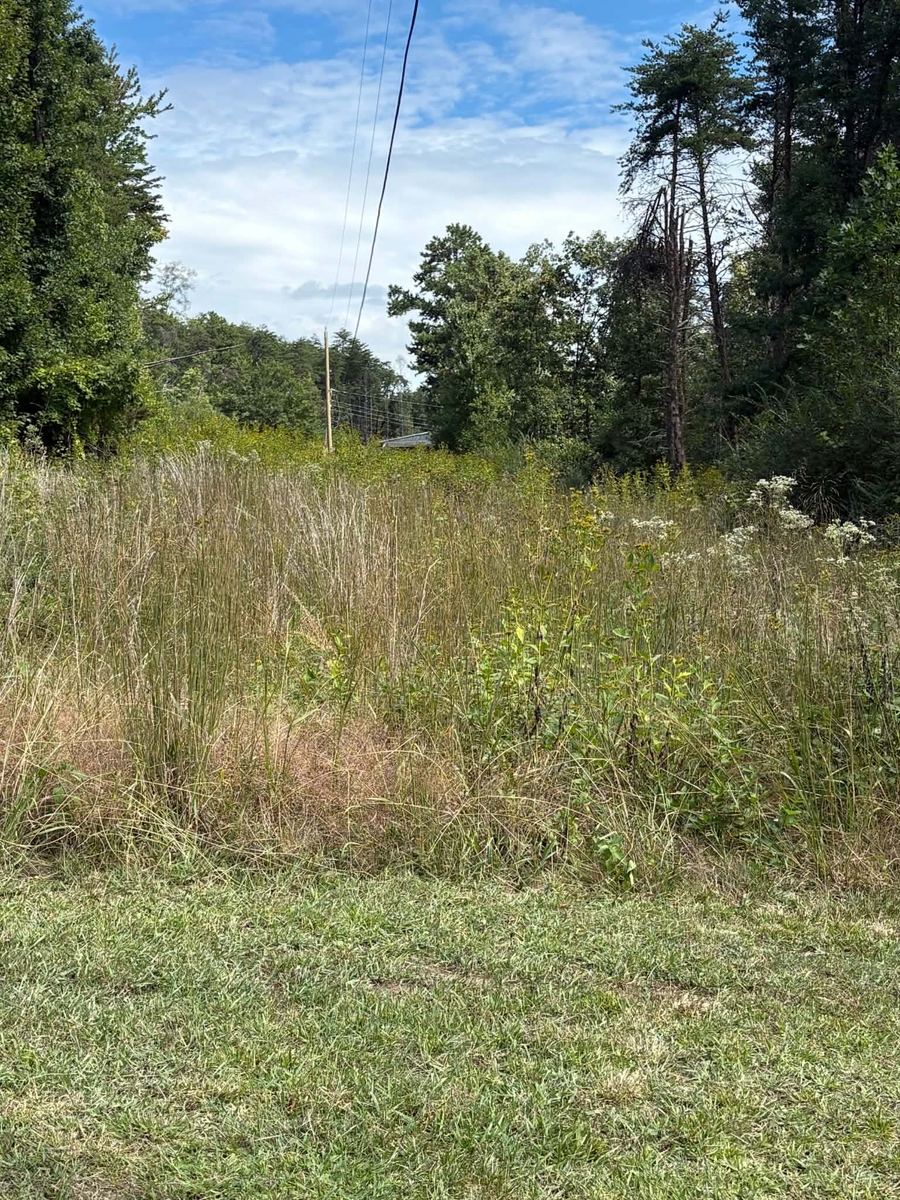
And still, after years of maps, plans, meetings, routes, negotiations, and promises, Sycamore remains worlds away by road.